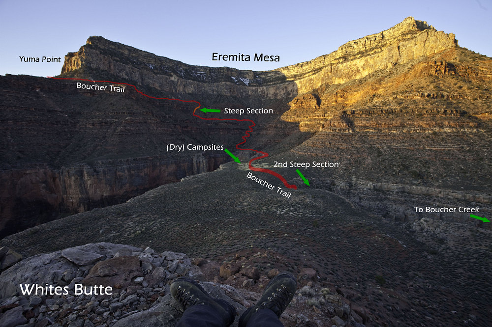
Travertine Canyon Annotated
I walked up close to the summit of Whites Butte and took this shot looking back at our camp and of the entire upper drainage of Travertine Canyon. The annotations give a description of exactly what the Boucher Trail does in the section from Yuma Point all the way down to the top of its descent of the Redwall. The 'steep bit' talked about in all of the route descriptions is denoted by the orange section.
I walked up close to the summit of Whites Butte and took this shot looking back at our camp and of the entire upper drainage of Travertine Canyon. The annotations give a description of exactly what the Boucher Trail does in the section from Yuma Point all the way down to the top of its descent of the Redwall. The 'steep bit' talked about in all of the route descriptions is denoted by the orange section.

This image is from the presentation "Grand Canyon - Boucher, Tonto, Bright Angel - Backpack Day 2: Boucher Creek and Rapids".
 Go to presentation where this image occurs.
 Go to location in presentation where this image occurs.
 Go to presentation where this image occurs.
 Go to location in presentation where this image occurs.
Copyright 2001-2016 alavigne.net.
