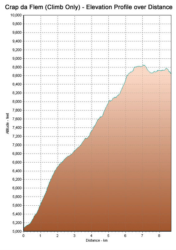
This is a GPS-derived elevation profile of our climb of Crap da Flem, graphed over distance. Note that this graph does not include the Bus ride to Bargis, nor the chairlift descent from Fil de Cassons.
This image is from the presentation "Europe with Asmir and Miriam - Hiking the Crap Da Flem".
 Go to presentation where this image occurs.
Go to location in presentation where this image occurs.
Go to presentation where this image occurs.
Go to location in presentation where this image occurs.
Copyright 2001-2016 alavigne.net.