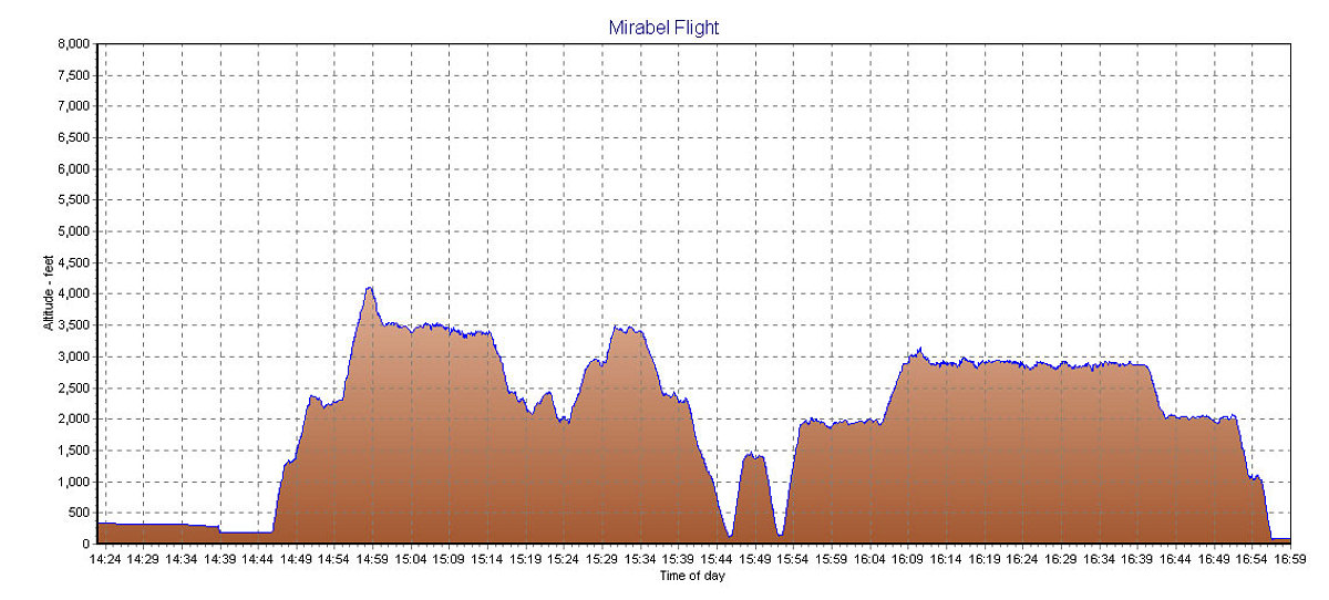
A GPS-derived elevation profile of our flight, plotted against time.
This image is from the presentation "Mirabel Flight 2003".
 Go to presentation where this image occurs.
Go to location in presentation where this image occurs.
Go to presentation where this image occurs.
Go to location in presentation where this image occurs.
Copyright 2001-2016 alavigne.net.