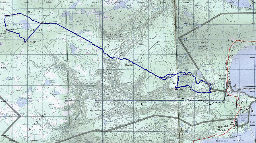
This is a section of 1:50:000 topo map, with the track of our particular journey to White Hill overlain on top.
This image is from the presentation "White Hill - The Highest point in Nova Scotia".
 Go to presentation where this image occurs.
Go to location in presentation where this image occurs.
Go to presentation where this image occurs.
Go to location in presentation where this image occurs.
Copyright 2001-2016 alavigne.net.