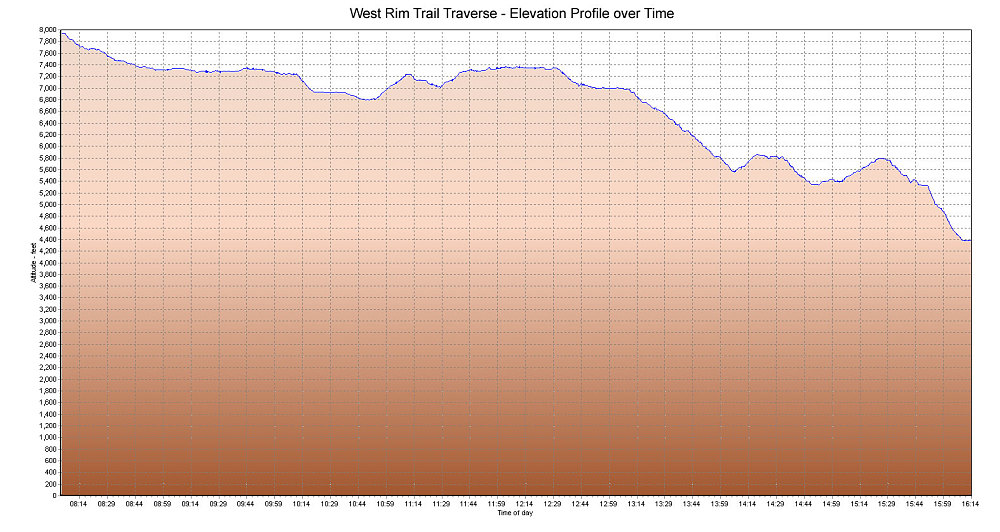
A GPS-derived elevation profile of our traverse of the West Rim Trail in Zion, graphed over time.
This image is from the presentation "An aMAZEing Trip to Color Country - The Maze, Escalante, and Zion - The West Rim Trail".
 Go to presentation where this image occurs.
Go to location in presentation where this image occurs.
Go to presentation where this image occurs.
Go to location in presentation where this image occurs.
Copyright 2001-2016 alavigne.net.