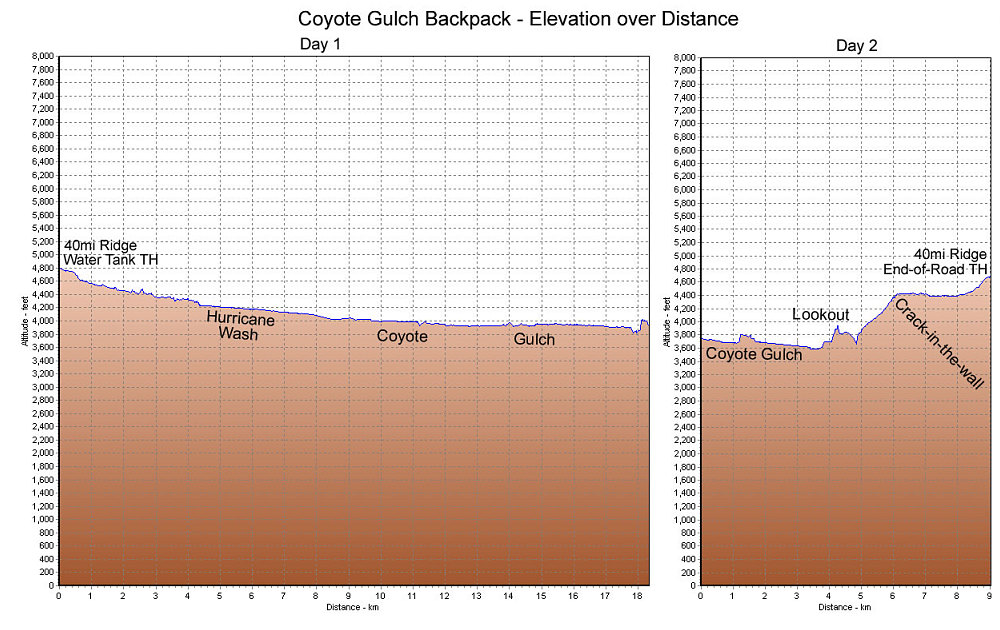
A GPS-derived elevation profile of our two-day backpack in Coyote Gulch, graphed over distance.
This image is from the presentation "Exploring the Escalante".
 Go to presentation where this image occurs.
Go to location in presentation where this image occurs.
Go to presentation where this image occurs.
Go to location in presentation where this image occurs.
Copyright 2001-2016 alavigne.net.