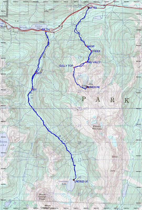
This is an annotated topographic map of both our Elk River-Landslide Lake and Kings Peak hikes.
This image is from the presentation "Vancouver Island 2005".
 Go to presentation where this image occurs.
Go to location in presentation where this image occurs.
Go to presentation where this image occurs.
Go to location in presentation where this image occurs.
Copyright 2001-2016 alavigne.net.