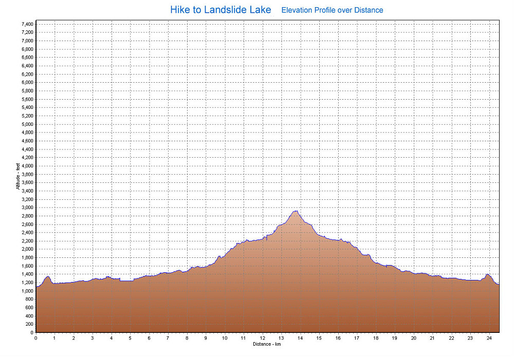
A GPS-derived elevation graph of our Elk Lake (and Puzzle Mountain aborted attempt) hike, graphed over distance.
This image is from the presentation "Vancouver Island 2005".
 Go to presentation where this image occurs.
Go to location in presentation where this image occurs.
Go to presentation where this image occurs.
Go to location in presentation where this image occurs.
Copyright 2001-2016 alavigne.net.