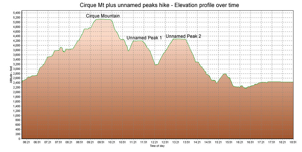
This is a GPS-derived elevation plot of the Luc's Cirque mountain plus un-named peaks dayhike, graphed over time.
This image is from the presentation "Tragedy in the Torngats - Maps and Graphs".
 Go to presentation where this image occurs.
Go to location in presentation where this image occurs.
Go to presentation where this image occurs.
Go to location in presentation where this image occurs.
Copyright 2001-2016 alavigne.net.