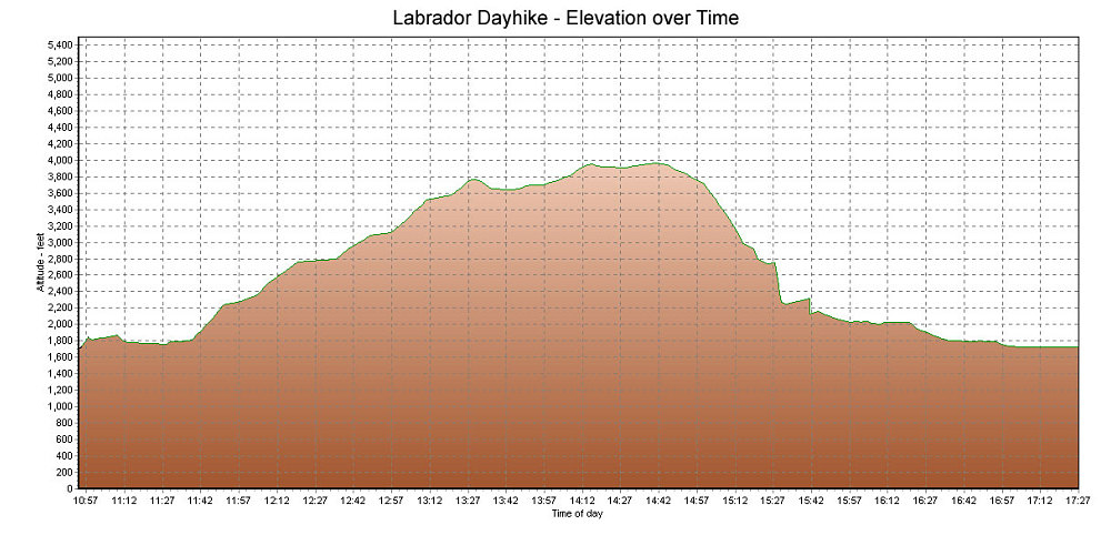
This is a GPS-derived elevation plot of the 'dayhike to Labrador' that was done with the three river Canoeists: Joel, Chris, and Jimmy. Graphed over time.
This image is from the presentation "Tragedy in the Torngats - Maps and Graphs".
 Go to presentation where this image occurs.
Go to location in presentation where this image occurs.
Go to presentation where this image occurs.
Go to location in presentation where this image occurs.
Copyright 2001-2016 alavigne.net.