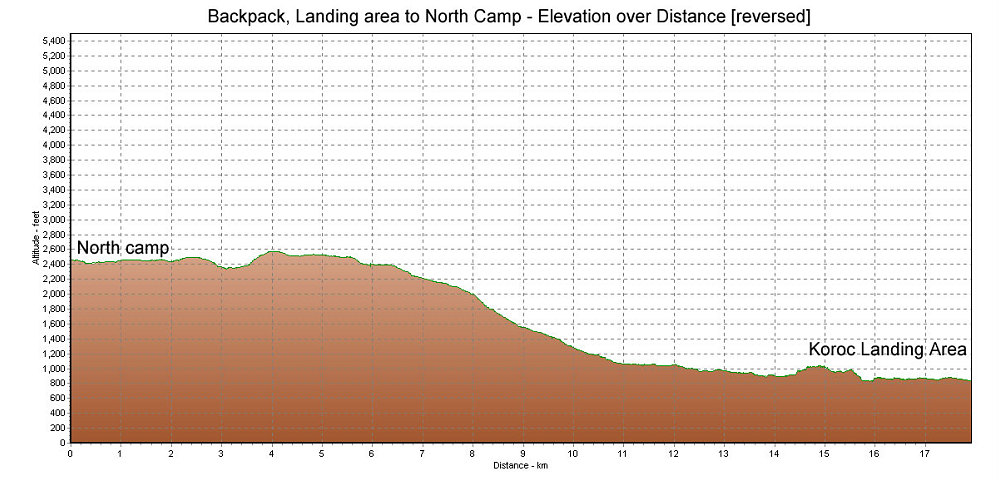
This is a GPS-derived elevation plot of the north team's return to the Koroc Landing Area, graphed over distance.
This image is from the presentation "Tragedy in the Torngats - Maps and Graphs".
 Go to presentation where this image occurs.
Go to location in presentation where this image occurs.
Go to presentation where this image occurs.
Go to location in presentation where this image occurs.
Copyright 2001-2016 alavigne.net.