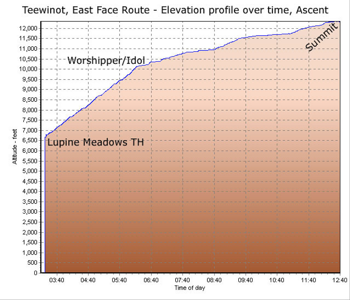
This is a GPS-derived elevation profile (over time) of the climb of Teewinot. As you can see, we made very good time until about 10,000 feet, and then slowed up big time.
This image is from the presentation "A Rocky Road Trip - Maps and Graphs".
 Go to presentation where this image occurs.
Go to location in presentation where this image occurs.
Go to presentation where this image occurs.
Go to location in presentation where this image occurs.
Copyright 2001-2016 alavigne.net.