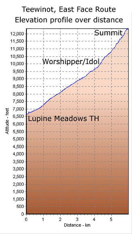
This is a GPS-derived elevation profile (over distance) of the climb of Teewinot. Only the ascent portion is shown (the descent is pretty much identical but in reverse).
This image is from the presentation "A Rocky Road Trip - Maps and Graphs".
 Go to presentation where this image occurs.
Go to location in presentation where this image occurs.
Go to presentation where this image occurs.
Go to location in presentation where this image occurs.
Copyright 2001-2016 alavigne.net.