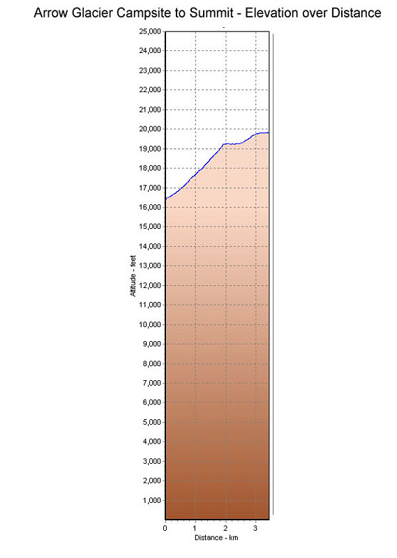
Elevation profile over distance
This is a GPS-Derived Elevation profile of the route from the Arrow Glacier camp to the summit, graphed over distance.
This image is from the presentation "Kilimanjaro and East Africa - Umbwe and Western Breach Climbing Guide".
 Go to presentation where this image occurs.
Go to location in presentation where this image occurs.
Go to presentation where this image occurs.
Go to location in presentation where this image occurs.
Copyright 2001-2016 alavigne.net.