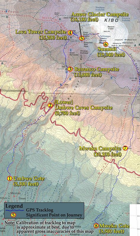
This is a topographic map, overlain with my actual GPS tracklog, of the entire eight days of the climb. Please be aware that because of [apparent] large inaccuracies in the topographic map, the calibration of the tracklog to the map is quite a bit off. (I know for sure that the GPS's tracklog is quite accurate!)
This image is from the presentation "Kilimanjaro and East Africa - Main Narrative".
 Go to presentation where this image occurs.
Go to location in presentation where this image occurs.
Go to presentation where this image occurs.
Go to location in presentation where this image occurs.
Copyright 2001-2016 alavigne.net.