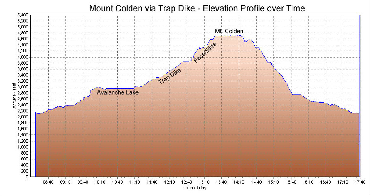
This is the GPS-derived elevation profile of the route, over time.
This image is from the presentation "A Climb of the Trap Dike on Mount Colden".
 Go to presentation where this image occurs.
Go to location in presentation where this image occurs.
Go to presentation where this image occurs.
Go to location in presentation where this image occurs.
Copyright 2001-2016 alavigne.net.