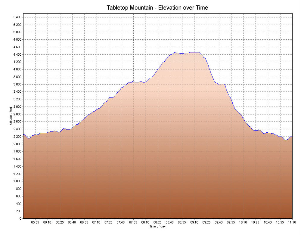
This is a GPS-derived elevation profile of our climb, graphed over time.
This image is from the presentation "Winter Ascent of Tabletop".
 Go to presentation where this image occurs.
Go to location in presentation where this image occurs.
Go to presentation where this image occurs.
Go to location in presentation where this image occurs.
Copyright 2001-2016 alavigne.net.