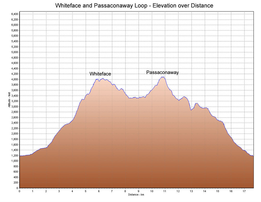
This is a GPS-Derived elevation plot of our Whiteface and Passaconaway loop hike, graphed over distance.
This image is from the presentation "Whiteface and Passaconaway".
 Go to presentation where this image occurs.
Go to location in presentation where this image occurs.
Go to presentation where this image occurs.
Go to location in presentation where this image occurs.
Copyright 2001-2016 alavigne.net.